Showing
1 - 20
results of
51
for search '
Phillips, Thomas, 1635?-1693
'
Skip to content
Toggle navigation
NLI Website
- Catalogue -
English
Gaeilge
Home
Help
Advanced Search
Browse
Orders
Ask a Librarian
Language
English
Gaeilge
All Fields
Title
Author
Subject
Call Number
ISBN/ISSN
Publisher
Coordinates
Search digitised content only
FIND
Author
Phillips, Thomas, 1635?-1693
Results
Showing
1 - 20
results of
51
for search '
Phillips, Thomas, 1635?-1693
'
, query time: 0.05s
List
Grid
Sort
Relevance
Newest First
Oldest First
Call Number
Author
Title
1
2
3
Next
3
A draught of the Castle of Dublin at present,
[1685].
Map
Main Creator:
Phillips
,
Thomas
,
1635
?-
1693
Language:
English
Format:
Map
In collection:
Phillips Maps.
Published / Created
[1685].
Notes
Executed "By directions of his Majestie King Charles...
Call Number:
Loading...
Located:
Loading...
View image
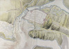
The ground plott of Derry Woragh [Derrywarragh] at the foot of the River Black-Water :
[1685].
5 miles belowe [sic] Charlemont, which is capable of being made strong /
Map
Main Creator:
Phillips
,
Thomas
,
1635
?-
1693
Language:
English
Format:
Map
Published / Created
[1685].
Notes
Exhibits signs of 'pricking', a means by which exact...
Call Number:
Loading...
Located:
Loading...
View image
The Citty [sic] of Waterford /
[1685].
Map
Main Creator:
Phillips
,
Thomas
,
1635
?-
1693
Language:
English
Format:
Map
Published / Created
[1685].
Notes
Physical description: 1 sheet : 19 x 29 inches. Geogr...
Call Number:
Loading...
Located:
Loading...
View image
A draught of Culmore Fort with a new designe of fortifying the same /
[1685].
Map
Main Creator:
Phillips
,
Thomas
,
1635
?-
1693
Language:
English
Format:
Map
Published / Created
[1685].
Notes
Exhibits signs of 'pricking', a means by which exact...
Call Number:
Loading...
Located:
Loading...
View image
The ground plaine of Carrick-fergus, with ye strengthening of the castle if thought neccessary,
[1685].
Map
Main Creator:
Phillips
,
Thomas
,
1635
?-
1693
Language:
English
Format:
Map
Published / Created
[1685].
Notes
Originally bound in volume entitled "Rules Orders and...
Call Number:
Loading...
Located:
Loading...
The ground plaine of Galway,
[1685].
Map
Main Creator:
Phillips
,
Thomas
,
1635
?-
1693
Language:
English
Format:
Map
Published / Created
[1685].
Notes
"Page 45" inscribed on verso. Executed "By direction...
Call Number:
Loading...
Located:
Loading...
View image
The profile of the cittadell [sic] of Dublin,
[1685].
Map
Main Creator:
Phillips
,
Thomas
,
1635
?-
1693
Language:
English
Format:
Map
Published / Created
[1685].
Notes
"Page 14" inscribed on verso. Executed "By direction...
Call Number:
Loading...
Located:
Loading...
View image
The citty [sic] of Londonderry,
[1685].
Map
Main Creator:
Phillips
,
Thomas
,
1635
?-
1693
Language:
English
Format:
Map
Published / Created
[1685].
Notes
"Page 66" inscribed on verso. Executed "By direction...
Call Number:
Loading...
Located:
Loading...
View image
Corke [sic] Harbour at large /
[1685].
Map
Main Creator:
Phillips
,
Thomas
,
1635
?-
1693
Language:
English
Format:
Map
Published / Created
[1685].
Notes
Physical description: 1 sheet : 42 x 38 inches. Geogr...
Call Number:
Loading...
Located:
Loading...
View image
A draught of Culmore Fort with a new designe of fortifying the same,
[1685].
Map
Main Creator:
Phillips
,
Thomas
,
1635
?-
1693
Language:
English
Format:
Map
Published / Created
[1685].
Notes
"Page 67" inscribed on verso. Executed "By direction...
Call Number:
Loading...
Located:
Loading...
View image
The citty [sic] of London Derry [sic]/
[1685].
Map
Main Creator:
Phillips
,
Thomas
,
1635
?-
1693
Language:
English
Format:
Map
Published / Created
[1685].
Notes
Exhibits signs of 'pricking', a means by which exact...
Call Number:
Loading...
Located:
Loading...
View image
Rules Orders and Directions for Regulateing [sic] the Office of the Ordnance in Ireland. Together with exact Surveys fo the Cheife [sic] Harbours, Forts, and Fortifications, in the said Kingdom, & Estimates of ye Charge for Fortifying ye most Important Places therein,
1685.
Map
Main Creator:
Phillips
,
Thomas
,
1635
?-
1693
Language:
English
Format:
Map
In collection:
Phillips Maps.
Published / Created
1685.
Notes
Executed "By directions of his Majestie King Charles...
Call Number:
Loading...
Located:
Loading...
A prospect of the head-land of Derry Woragh [Derrywarragh Island],
[1685].
Map
Main Creator:
Phillips
,
Thomas
,
1635
?-
1693
Language:
English
Format:
Map
Published / Created
[1685].
Notes
"Page 56" inscribed on verso. Executed "By direction...
Call Number:
Loading...
Located:
Loading...
View image
A ground plaine of ye redoubt for Corke [sic],
[1685].
Map
Main Creator:
Phillips
,
Thomas
,
1635
?-
1693
Language:
English
Format:
Map
Published / Created
[1685].
Notes
"Page 30" inscribed on verso. Executed "By direction...
Call Number:
Loading...
Located:
Loading...
View image
Corke Harbour,
[1685].
Map
Main Creator:
Phillips
,
Thomas
,
1635
?-
1693
Language:
English
Format:
Map
Published / Created
[1685].
Notes
Physical description: 1 sheet : 21 x 39 inches. Geogr...
Call Number:
Loading...
Located:
Loading...
View image
Phillips Maps.
Map
Main Creator:
Phillips
,
Thomas
,
1635
?-
1693
Language:
English
Format:
Map
Published / Created
[1685].
Notes
MS 3137 was presented to the National Library by the...
Call Number:
Loading...
Located:
Loading...
The ground plott of Derry Woragh [Derrywarragh] at the foot of the Black Water 5 miles below Charlemont, which is capable of being made strong,
[1685].
Map
Main Creator:
Phillips
,
Thomas
,
1635
?-
1693
Language:
English
Format:
Map
Published / Created
[1685].
Notes
"Page 55" inscribed on verso. Executed "By direction...
Call Number:
Loading...
Located:
Loading...
View image
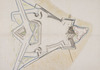
A draught of the cittadell [sic] to be built over Dublin /
[1685].
Map
Main Creator:
Phillips
,
Thomas
,
1635
?-
1693
Language:
English
Format:
Map
Published / Created
[1685].
Notes
Physical description: 1 sheet : 39 x 28 inches. Geogr...
Call Number:
Loading...
Located:
Loading...
View image
A prospect of Passage, ye river downe to Duncannon,
[1685].
Map
Main Creator:
Phillips
,
Thomas
,
1635
?-
1693
Language:
English
Format:
Map
Published / Created
[1685].
Notes
Executed "By directions of his Majestie King Charles...
Call Number:
Loading...
Located:
Loading...
View image
Kinsale Harbour,
[1685].
Map
Main Creator:
Phillips
,
Thomas
,
1635
?-
1693
Language:
English
Format:
Map
Published / Created
[1685].
Notes
"Page 35" inscribed on verso. Executed "By direction...
Call Number:
Loading...
Located:
Loading...
View image
1
2
3
Next
3
Get RSS Feed
Email this Search
History
Narrow Search
Digitised
Remove Filters
Clear Filter
Genre: Early works to 1800
Format
51
Map
Online Availability
49
Digitised
2
Not Digitised
Published / Created
From:
To:
Subject
51
Maps
51
Maps, Manuscript
24
Fortification
3
Rivers
2
Fortifcation
1
Fortifications
Author
51
Phillips, Thomas, 1635?-1693
Collections
3
Phillips Maps.
Language
51
English
Genre
Early works to 1800
43
Maps
Era
1
18th century
Region
34
Ireland
17
Northern Ireland
6
Cork (Ireland : County)
6
Derry (Northern Ireland)
5
Dublin
4
Belfast Lough (Northern Ireland)
more ...
4
Cork Harbour (Ireland)
4
Great Island (Ireland)
4
Kinsale (Ireland)
4
Waterford Harbour (Ireland)
3
Bandon River (Ireland)
3
Charles Fort (Ireland)
3
Cork (Ireland)
3
Derrywarragh Island (Northern Ireland)
3
Kinsale
3
Passage East (Ireland)
3
Spike Island (Ireland)
3
Suir River (Ireland)
2
Athlone
2
Athlone (Ireland)
2
Belfast
2
Belfast (Northern Ireland)
2
Blackwater River (Northern Ireland)
2
Carrickfergus
2
Carrickfergus (Northern Ireland)
2
Charlemont (Northern Ireland)
2
Copeland Islands (Northern Ireland)
2
Cork
2
Corrib, River (Ireland)
2
Culmore Fort (Northern Ireland)
see all ...
less ...
Loading...
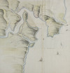
![The ground plott of Derry Woragh [Derrywarragh] at the foot of the River Black-Water : 5 miles belowe [sic] Charlemont, which is capable of being made strong /](/IIIF/000280000/000278070/vtls000278070_001.jp2/full/100,/0/default.jpg)
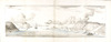
![The Citty [sic] of Waterford /](/IIIF/000280000/000277858/vtls000277858_001.jp2/full/100,/0/default.jpg)

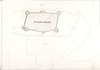
![The profile of the cittadell [sic] of Dublin,](http://www.nli.ie/digital/thumbs/vtls000280438.jpg)
![The citty [sic] of Londonderry,](http://www.nli.ie/digital/thumbs/vtls000277546.jpg)
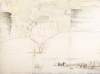
![Corke [sic] Harbour at large /](/IIIF/000280000/000277795/vtls000277795_001.jp2/full/100,/0/default.jpg)
![The citty [sic] of London Derry [sic]/](/IIIF/000280000/000278086/vtls000278086_001.jp2/full/100,/0/default.jpg)
![A prospect of the head-land of Derry Woragh [Derrywarragh Island],](http://www.nli.ie/digital/thumbs/vtls000277548.jpg)
![A ground plaine of ye redoubt for Corke [sic],](http://www.nli.ie/digital/thumbs/vtls000277560.jpg)

![The ground plott of Derry Woragh [Derrywarragh] at the foot of the Black Water 5 miles below Charlemont, which is capable of being made strong,](http://www.nli.ie/digital/thumbs/vtls000277544.jpg)
![A draught of the cittadell [sic] to be built over Dublin /](/IIIF/000280000/000277783/vtls000277783_001.jp2/full/100,/0/default.jpg)