Showing
1 - 1
results of
1
for search '
Currin, Michael, fl. 1768-1809, surveyor
'
Skip to content
Toggle navigation
NLI Website
- Catalogue -
English
Gaeilge
Home
Help
Advanced Search
Browse
Orders
Ask a Librarian
Language
English
Gaeilge
All Fields
Title
Author
Subject
Call Number
ISBN/ISSN
Publisher
Coordinates
Search digitised content only
FIND
Author
Currin, Michael, fl. 1768-1809, surveyor
Results
Showing
1 - 1
results of
1
for search '
Currin, Michael, fl. 1768-1809, surveyor
'
, query time: 0.02s
List
Grid
Sort
Relevance
Newest First
Oldest First
Call Number
Author
Title
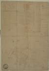
A map of lands at Windgate in the barony of Rathdown and County of Wicklow. Surveyed in August 1809 for the Rev. Thomas Brownrigg. By Michael Currin. Scale 20 perches to an inch. Table of reference showing tenants and acreage of holdings.
Map
Main Creator:
Currin
,
Michael
,
fl
.
1768
-
1809
,
surveyor
Language:
English
Format:
Map
In collection:
Longfield Map Collection
Published / Created
[August 1809]
Notes
Physical description: 1 map Geographic Coverage: Bar...
Call Number:
Loading...
Located:
Loading...
Get RSS Feed
Email this Search
History
Narrow Search
Digitised
Remove Filters
Clear Filter
Collections: Longfield Map Collection
Format
1
Map
Online Availability
1
Digitised
Published / Created
From:
To:
Subject
1
Administration of estates
1
Boundaries (Estates)
1
Land tenure
1
Land use surveys
Author
1
Currin, Michael, fl. 1768-1809, surveyor
Collections
Longfield Map Collection
Language
1
English
Genre
1
Manuscript maps
1
Maps, Manuscript
Region
1
Ireland
1
Rathdown (Barony)
1
Wicklow (County)
1
Wicklow (Ireland : County)
Loading...